Did an Israeli aircraft infringe Egypt’s airspace?
The IDF spokesman announced Friday, October 27th, 2023, at 9:54 a.m. that in the past few hours, an air threat in the Red Sea area, and that is how they interpreted the damage on Egyptian land. At that time, this announcement presented as a surprise as the IDF was the one announcing a security breach on Egyptian territory, probably referring to the explosion that occurred in Taba, south of Sinai.
At exactly 11:08 a.m. Cairo local time, Cairo News channel published a release on behalf of accredited Egyptian sources that said an “unidentified body” had fallen next to an electric power station in Nuweiba retreat on the Red Sea, Sinai; and further investigation is undergoing regarding the specifics of the incident.
Reuters cited “sources with knowledge of the matter” that an unidentified object fell in a deserted area near Nuweiba city near the Red Sea, while an eyewitness said he had heard an explosion and had seen clouds of dust at a distance.
Some videos from open source taken by citizens near the location where the body fell went viral following the publishing of the news. The videos showed a military aircraft flying at low altitude. An explosion took place followed by a cloud of dust in the sky, that was followed by an unidentified object near buildings inside Nuweiba city, whilst civilians were in panic.
Daniel Hagari, the IDF spokesman, went back to tweeting Friday evening, at exactly 17:58 pm; announcing that the Israeli air force alienated a hostile target outside “Israeli land” in the Red Sea area, and posted a video of the shooting down of the target.
The Egyptian Military spokesman stated at 20:56 pm Friday on the incident where a “hostile body” was shot down over Nuweiba city, where he said: “Investigations on the two drones crashed on Taba and Nuweiba on Friday were coming from south of Red Sea to North. The outcome of the investigations revealed that one drone was targeted outside Egyptian airspace in the Gulf of Aqaba, resulting in debris falling in an uninhabited area in Nuweiba and the second one fell in Taba, an Egyptian military spokesperson said in a statement on Friday”.
To verify the facts about the incident, the “Digital Investigations Lab” at Sinai Foundation for Human Rights has undergone a thorough analysis of all available open-source information published by citizens and footage published by the IDF and surviving eyewitnesses in the area of the incident.
The Foundation has reached with utmost certainty the conclusion that the Israeli Defense forces have orchestrated an attack using a military aircraft within Egyptian airspace, with a minimum depth of 4 km in Sinai shooting down what they called a “hostile target” above a civilian location in Nuweiba city. This is according to evidence collected by the institution and verified by Military experts consulted by the Sinai Foundation.
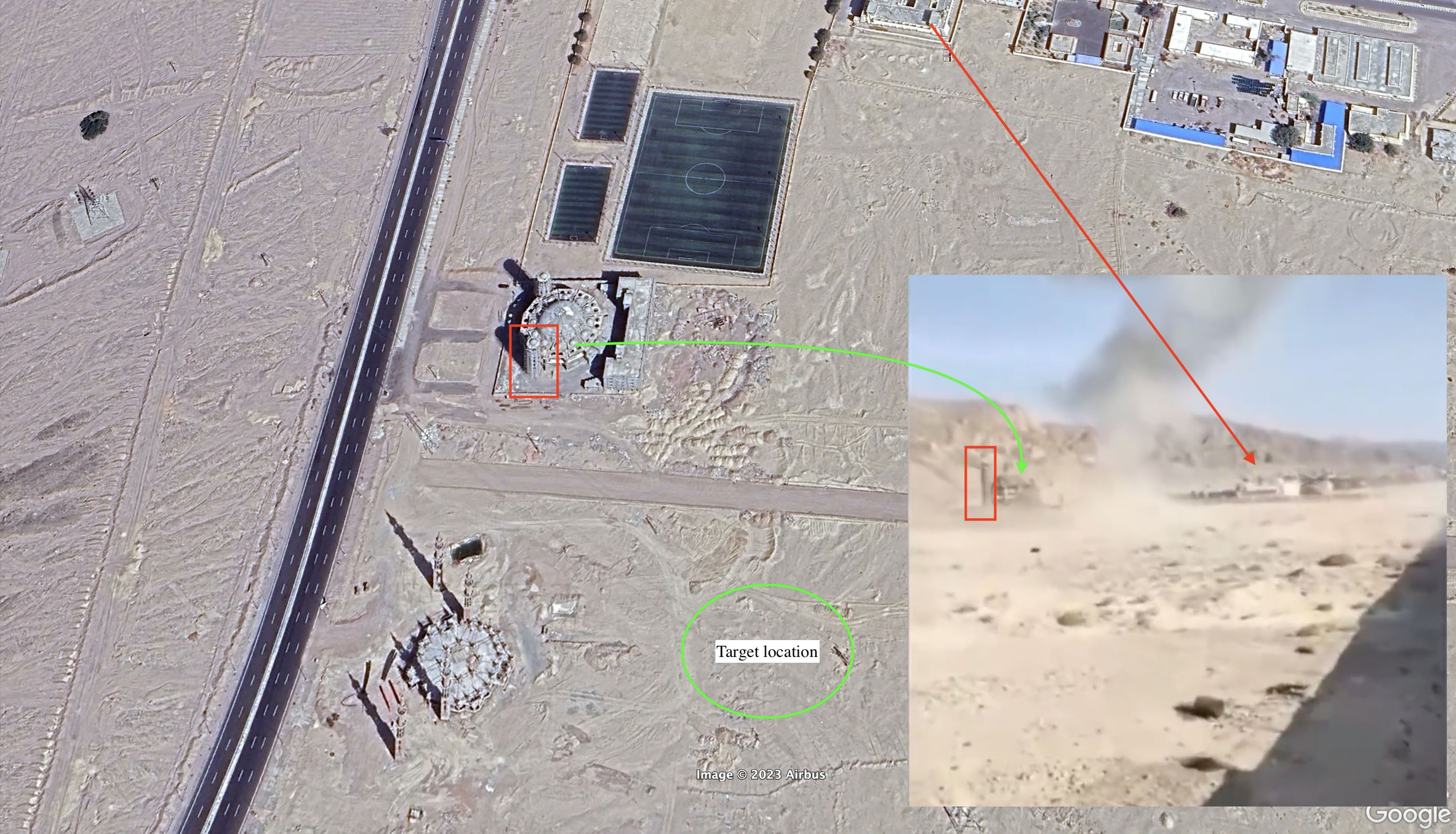
1- A viral video showed the moment when the “Hostile body” was shot down in Nuweiba city. The team was able to locate the area where it landed within the following coordinates 29°01'49.0"N 34°39'34.6"E
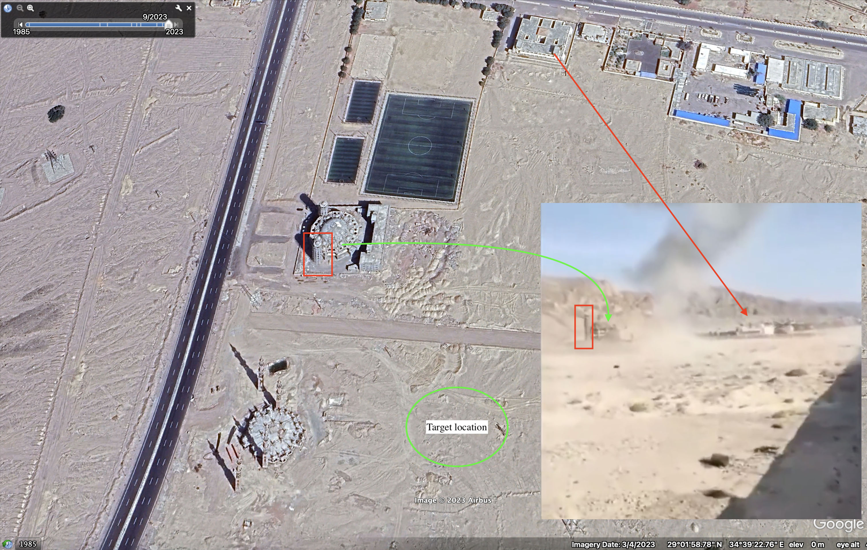
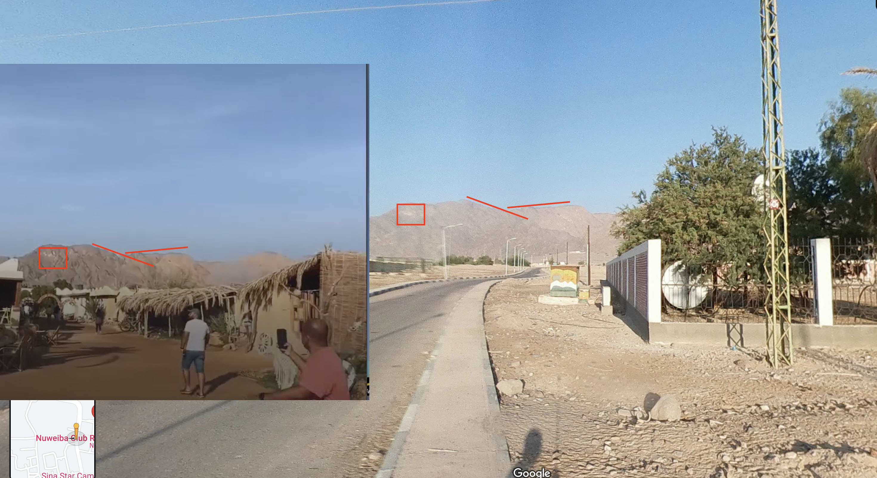
2- Another video captured by a civilian on a beach in Nuweiba, documenting the moment when the target was shot down in the air. The team was able to mark the location to the coordinates: 29°01'43.6"N 34°40'26.9"E, where the mountain shapes are demonstrated in the following photo:
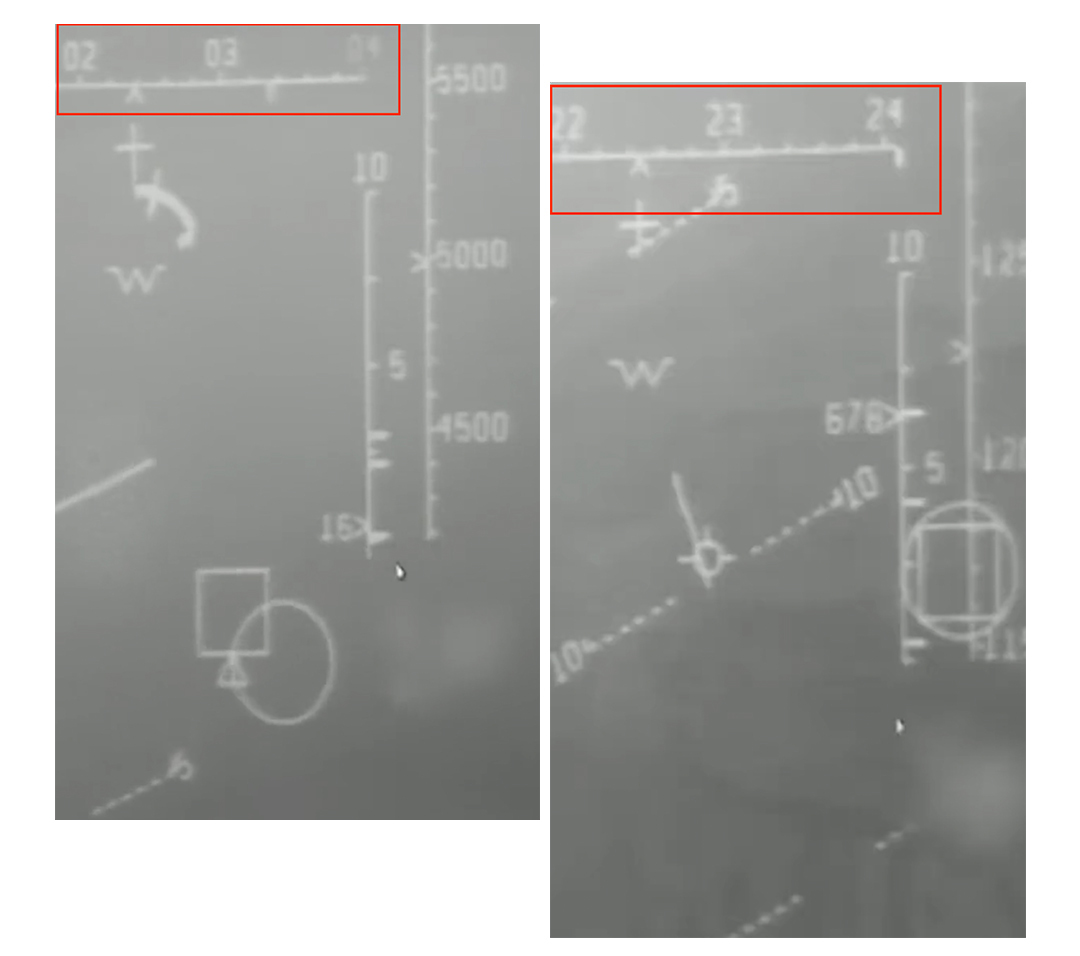
3- The video published by the IDF spokesman, documenting the shooting down of a hostile object by an Israeli aircraft the following data:
-
According to the aircraft’s recorded data, the aircraft’s altitude was 12000 ft which descended to 4500 ft - approximately 1.5 km above sea level - making the plane visible to civilians on the ground.
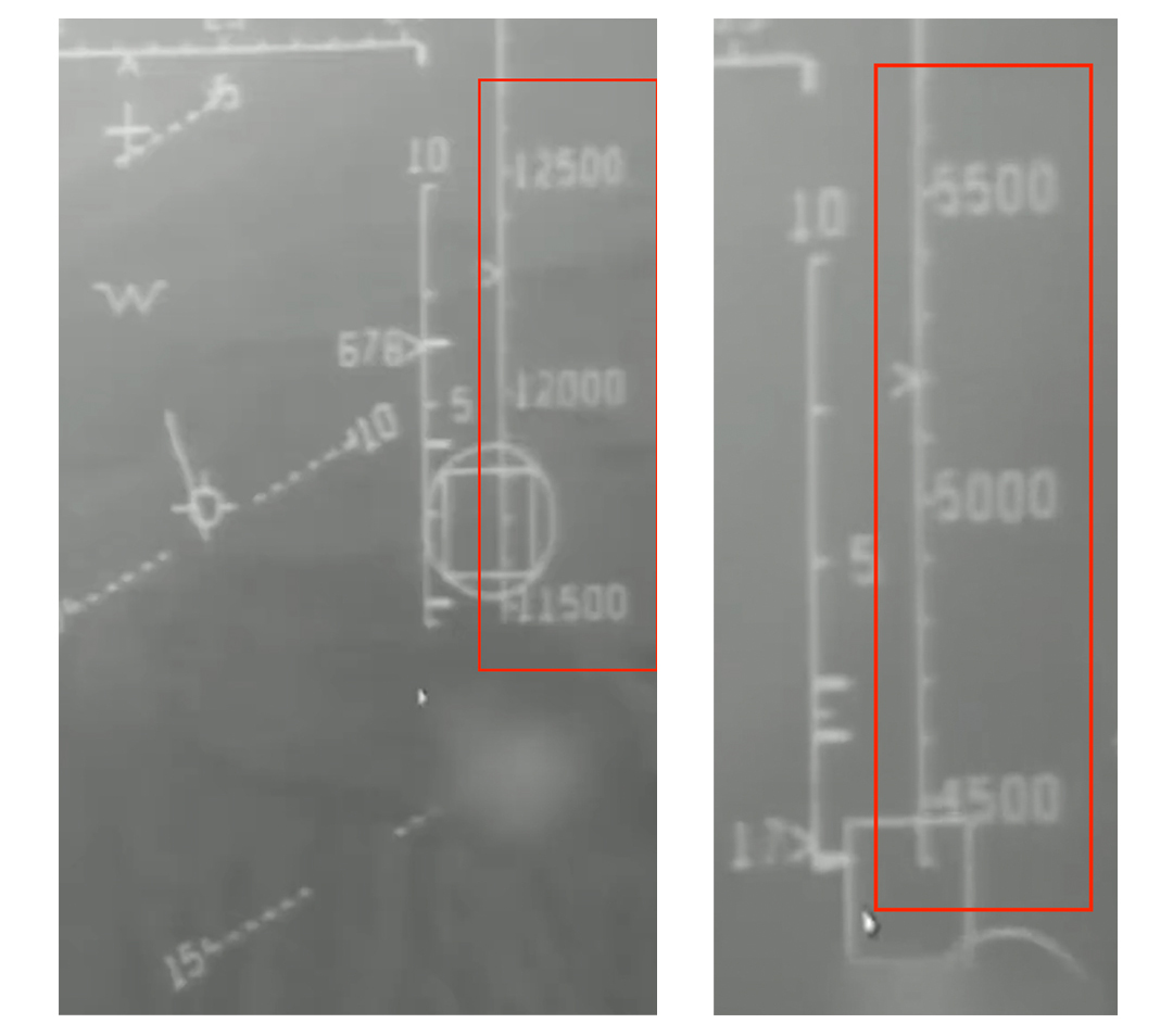
The aircraft compass showed the number 22 which modifies as time passes to get to 3 before the shooting of the flying body. These numbers mark the directions of the aircraft compass where 22 is southwest, and it was modified to 3 which is the southeastern direction.
-
The team translated the dialogue between the aircraft captain and the command center which verified that the aircraft was vertically above the target, at the same geographical area where it was shot down.
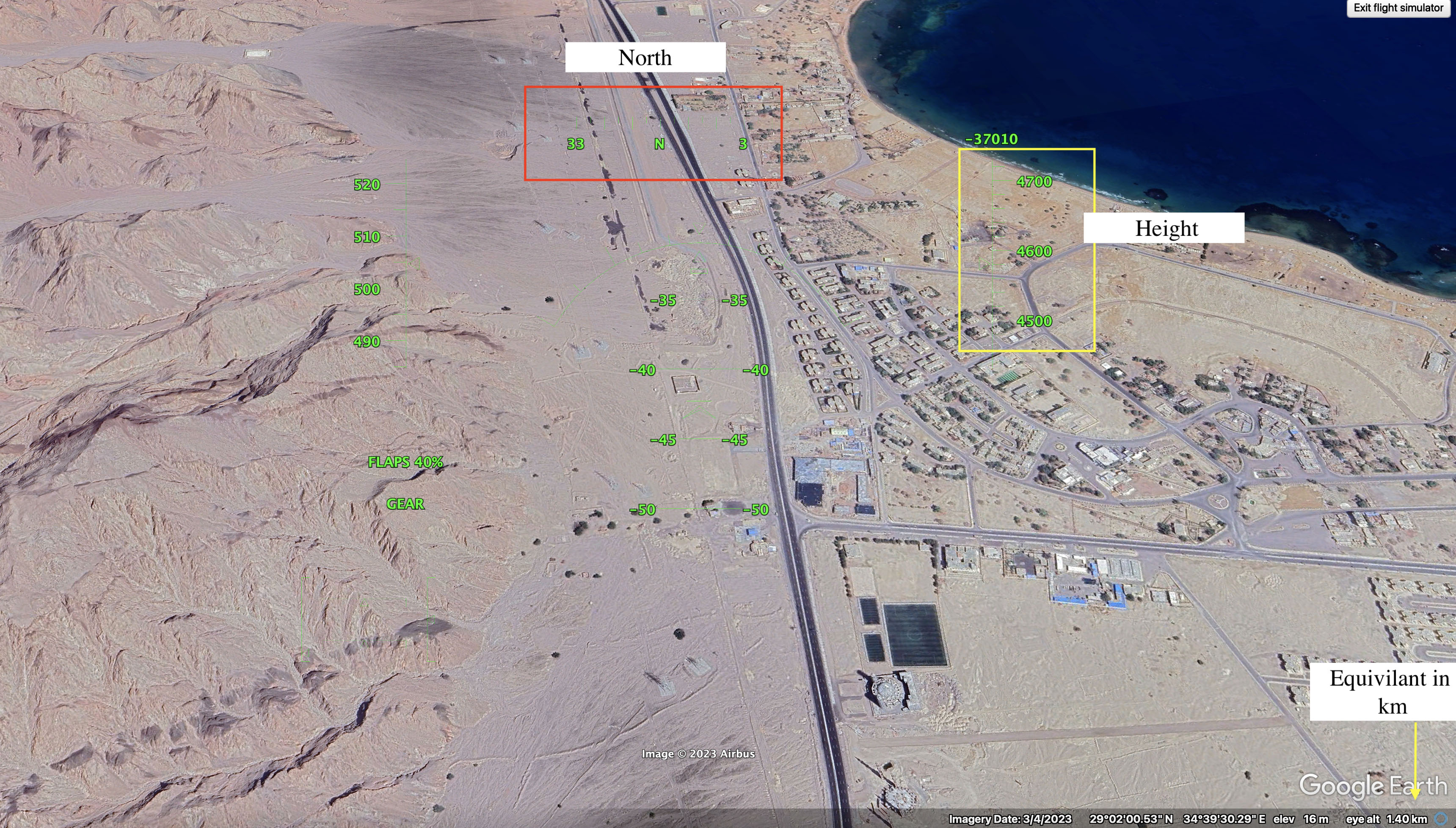
 This photo displays Google’s flight simulation with the same characteristics of the aircraft, altitude, and direction to the northeast.
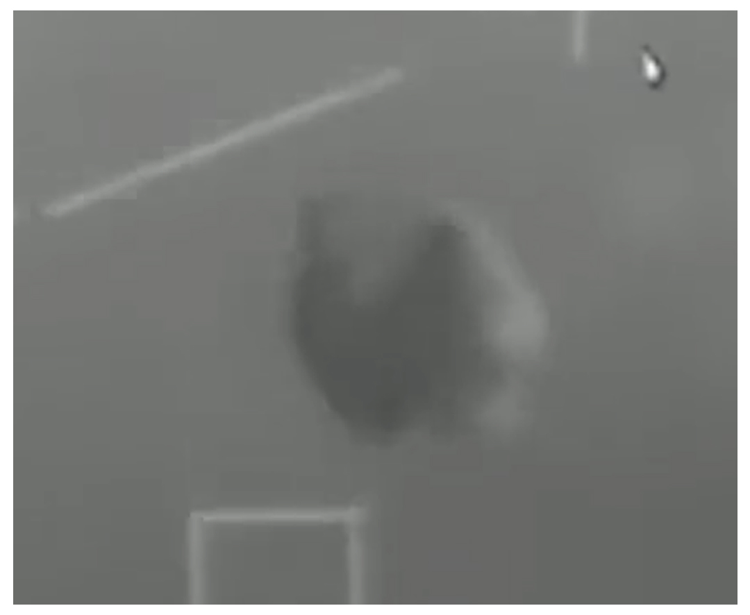
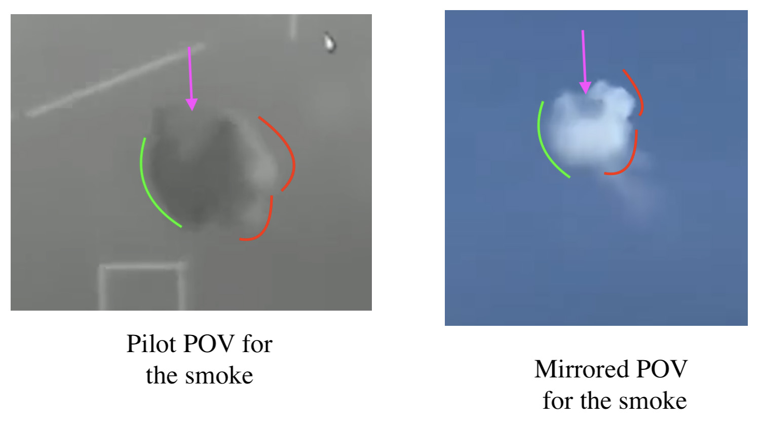
4- The video shows the cloud resulting from the explosion as follows:
-
The cloud is the same as captured on video from the ground; once the photography angle through the following photos:
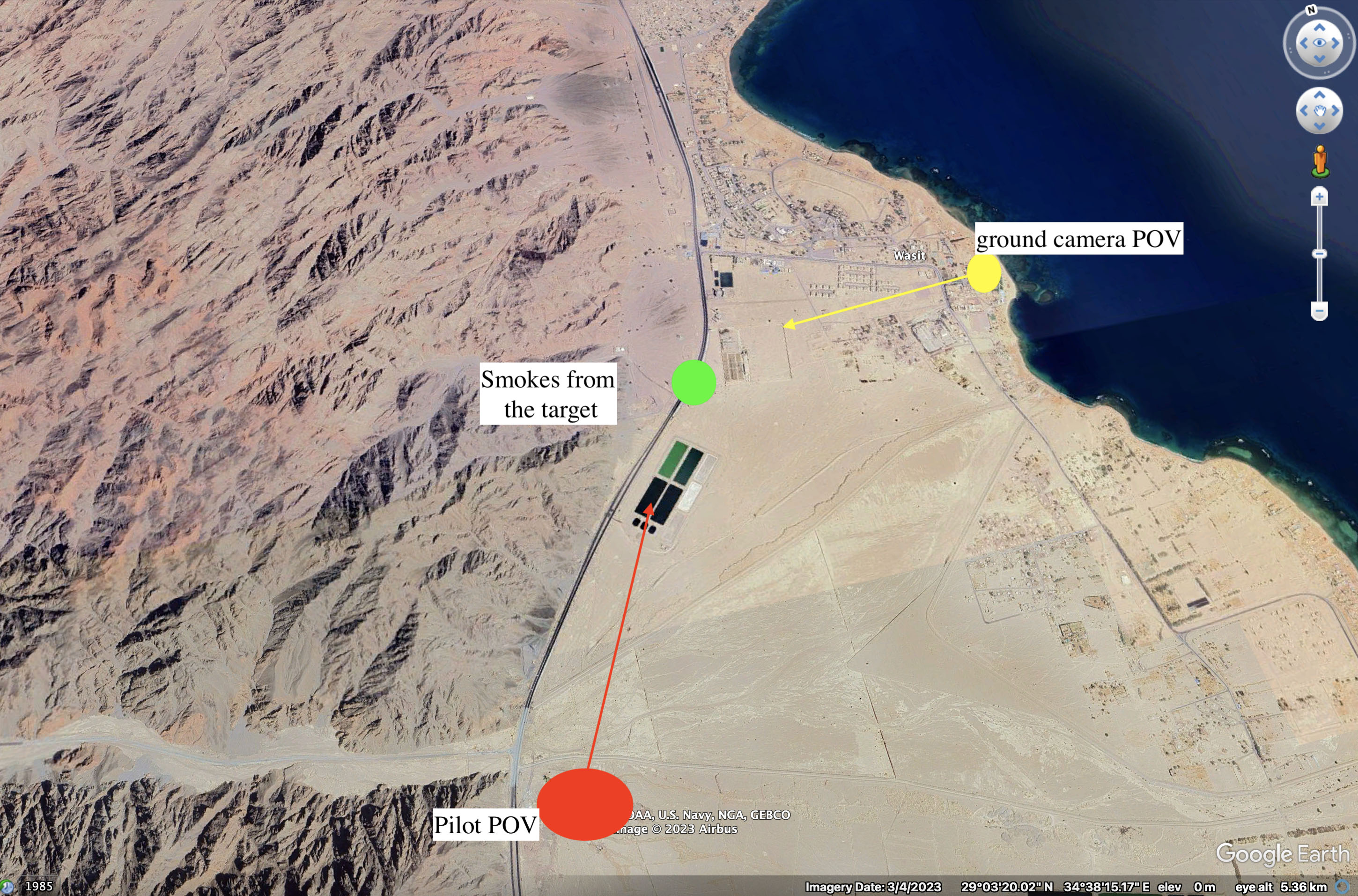
The photography angles that the aircraft camera views the cloud from a side and the ground camera views it almost the opposite, matching both pictures together, simply requires using the mirroring technique.
Original aircraft’s cloud footage vs mirrored ground camera cloud footage:
The Sinai Foundation demands that the Egyptian authorities commit to transparency and the citizens’ right to knowledge concerning the Israeli violations in the scope of the war on Gaza.
Tags
Related Postes
 English content


